Answer:
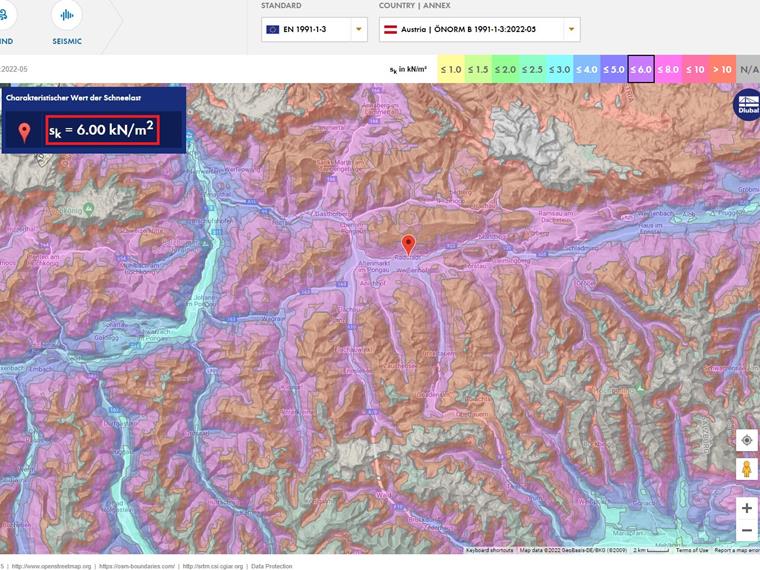
The differences between our snow load map and the HORA web application result from the interval of the data used. Our application strictly refers to the current standard ÖNORM B 1991‑1‑3:2022‑05 with an interval of 0.5 kN/m².
The HORA map, on the other hand, uses an interval of 0.1 kN/m². Thus, the Dlubal Geo-Zone Tool outputs more conservative, strictly standard-compliant values.
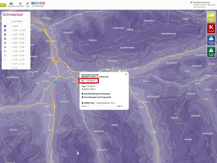
The images show the difference for the same coordinates at an example location in Austria. The eHORA map is shown above; our Geo-zone tool is shown below.


.png?mw=600&hash=49b6a289915d28aa461360f7308b092631b1446e)