The Snow Load, Wind Speed, and Seismic Load Maps page allows for Geo-load queries based on a dynamic map by Google Maps.
A Geo-load query can be generated by clicking on the interactive map of Snow Load, Wind Speed, and Seismic Load Maps.
Dlubal Software also provides a web service which can be used to generate a URL that provides the desired results of the Geo-load query.
The Geo-load query based on the map by Google Maps is an online service liable for costs.
For testing purposes, Dlubal Software GmbH provides a certain contingent of free Geo-load queries to its users.
To be able to track when a user exceeds this quota, Dlubal Software records the Geo-load queries of each user in order to prevent misuse of the free testing mode of the online service.
As soon as the quota of free Geo-load queries has been used up, the user is asked to purchase the desired online service or to log in to the relevant Dlubal account, if the company has already purchased the online service.
By purchasing a package of Geo-load queries, the corresponding quota of the Geo-load queries is activated for the company.
For billing purposes, Dlubal Software GmbH records the Geo-load queries of the individual users of this company and merges them in order to determine the used and the remaining number of Geo-load queries purchased by the company.


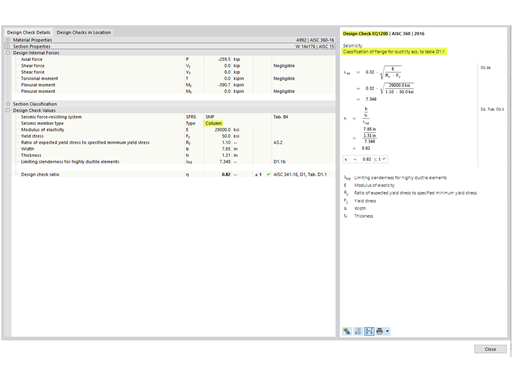
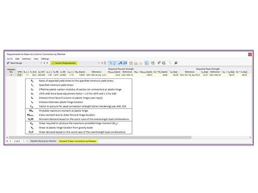


.png?mw=600&hash=49b6a289915d28aa461360f7308b092631b1446e)