


Answer:
The online service "Snow Load, Wind Speed, and Seismic Load Maps" can only save a constant value across a surface area.
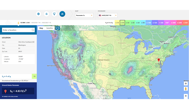
If the respective load standard recommends the isoline display of the load across the country instead of the usual zone classification, the interactive load map shows the areas between the isolines as zones with a constant value. In this case, the larger value of two enclosing isolines is always assigned to these zones.
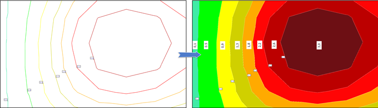
Accordingly, this "stepped" load display of the locations between the isolines leads to the conservative load determination.