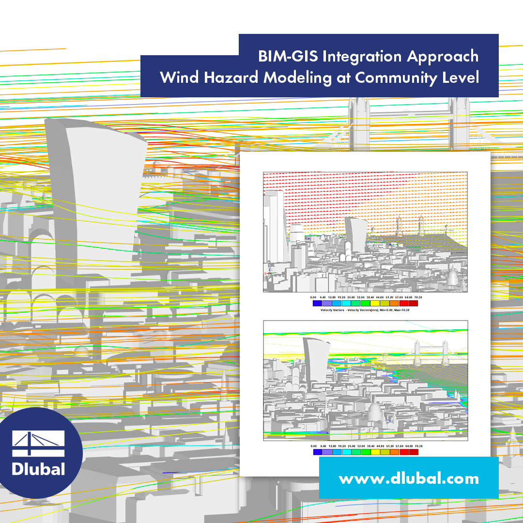
There is news! Today, it's a novel approach to the generation of CFD models at the community level. Building Information Modeling (BIM) and Geographic Information Systems (GIS) are integrated to automate the generation of a high-resolution 3D community model. Curious? Then read on! 💡
More Information: