The geometry of the soil solids of a soil massif can be edited manually as soon as you set the "Set of Soil Solids" type in the input dialog box.
Step 1 (optional) – Soil Massif from Soil Samples
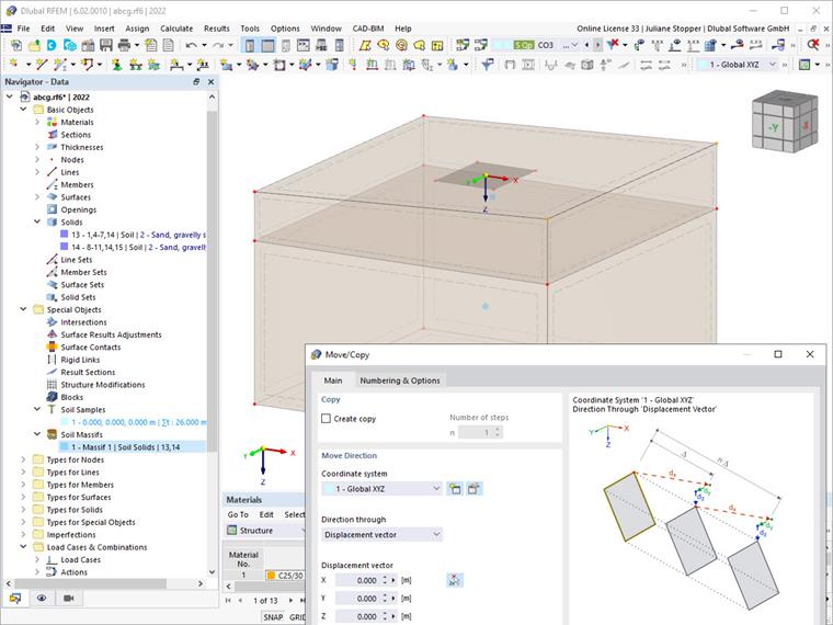
The massif can initially be generated from soil samples in order to take advantage of the generated soil solids with the soil materials and layer boundaries resulting from the ground investigation data contained in the soil samples.
This can be done in the first step, as shown in Image 02.
Step 2 – Setting the Soil Solid Set Type
In the second step, you can change the soil massif type from (1) Generated from Soil Samples to (2) Set of Soil Solids. After you confirm this step, the calculated coordinates of the soil massif appear. Image 03 shows this step in the Soil Massif dialog box.
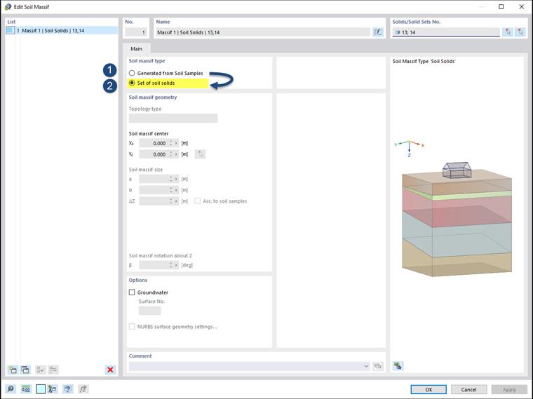
Note: Please note that this step cancels the "generated" status, which means, among other things, that the connection to the soil samples is disconnected in order to enable editing.
Step 3 – Editing Geometry of Soil Solids
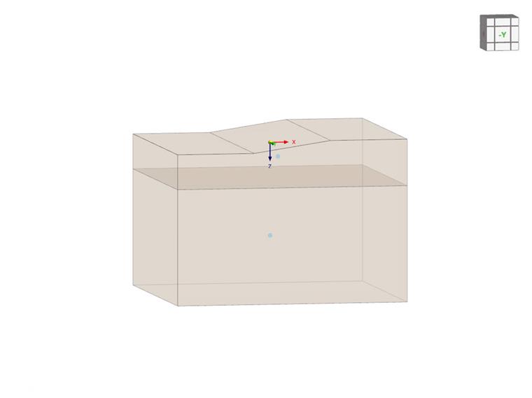
You can now edit the soil solids and create the desired geometry of the terrain surface using all the available and familiar tools in RFEM 6. You can see this step in Image 04.
The following image shows an example of the soil massif geometry created in compliance with Steps 1 to 3.