


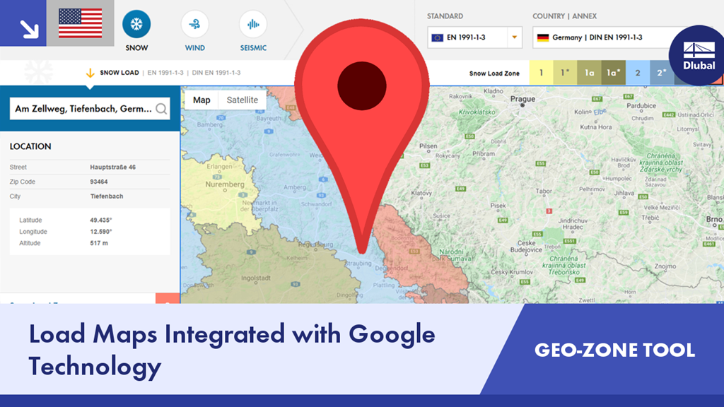
The GEO-ZONE TOOL contains interactive maps to quickly determine snow, wind, and seismic data according to multiple international standards. All calculated values are integrated with Google Maps location services.
Check out this video to see all the functions and options offered by the GEO-ZONE TOOL.
- Site-specific data according to national and international standards
- Print and screenshot function to document load data
- Integration with your personal website
- Web service (API) for external program integration