2 Wyniki
Wyświetl wyniki:
Sortuj według:
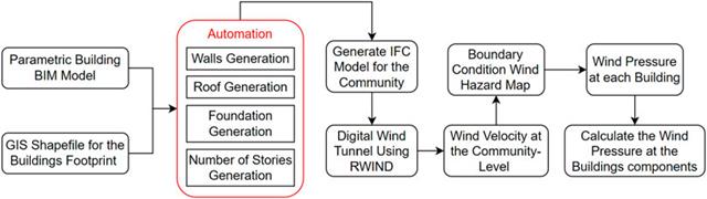
W artykule tym opracowano nowatorskie podejście do generowania modeli CFD na poziomie miejscowości poprzez połączenie modelowania informacji o budynku (BIM) i systemów informacji geograficznej (GIS) w celu zautomatyzowania generowania trójwymiarowego modelu terenu o wysokiej rozdzielczości, który zostanie wykorzystany jako dane wejściowe dla cyfrowego tunelu aerodynamicznego z wykorzystaniem RWIND.
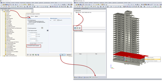
In RFEM und RSTAB kann in den Modell-Basisangaben unter dem Register "Optionen" ein "CAD/BIM-Modell" aktiviert werden. Dieses Modell ist neben der regulären Modelleingabe eine Ebene zum Einlesen, Organisieren und Transformieren von IFC-, STEP- und IGES-Dateien.