


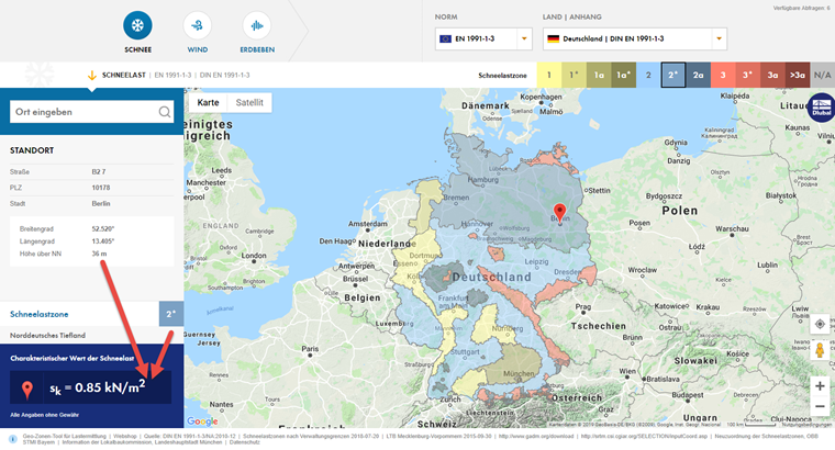
The online service "Snow Load, Wind Speed, and Seismic Load Maps" shows the snow load, wind speed, and seismic zones according to the relevant standards on Google Maps in many countries, and shows the location-specific loads of the corresponding load zone map displayed for the selected location on the map.
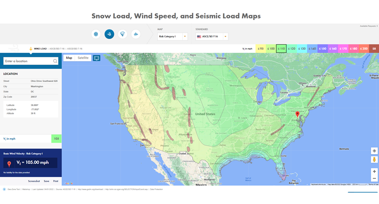
The location on the map can be defined either by using the search function provided on the website, or by clicking any location on the map.
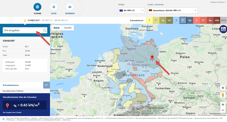
The associated load determination is linked to the selected location and always shows the location-specific load depending on the local load zone information and the height above sea level.
Since our online service uses the fee-based Google Maps services as a basis, we only provide a limited number of free geo-data queries (load determinations). If this limited number of load determinations is not sufficient for you, you can purchase one of our Geo-Zone Tool data query packages. These packages have a certain number of location-specific data queries for all stored contacts of the company.
In this case, the data query corresponds to a load determination depending on the selected zone map (load type) and location on the map. A possible change of the load type leads to another data query due to new zone information. Thus, in the standard case, each location requires at least 3 queries with regard to the determination of the local snow, wind, and seismic loads.