Answer:
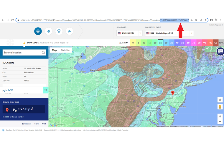
As the text box used to search for the location in the online service "Geo-Zone Tool: Snow, Wind, and Seismic Zone Maps" does not search the location database of the map, but completes the entry automatically with each new character, the numerical specification of geographic coordinates in this area is not successful.
However, one of the modifications of the URL address in full-screen mode allows you to move the pointer for the load determination to the desired geographic position.
To do this, enter the geocoordinates in the format [Latitude, Longitude] separated by a point in the last URL module after the "=" character.