


The raw data come from DIN EN 1998‑1/NA:2021‑07, including the additional digital content. The GPS coordinates and the response acceleration SaP, R in the plateau area of the response spectrum are available in the form of an Excel table. It shows the GPS coordinates for the latitude and longitude in decimal degrees with an accuracy of 0.1°.
The Geo-Zone tool also works with a grid size of 0.1°×0.1°. The values from the additional digital content are defined as a center of each cell. The result of the search query is then taken from the corresponding cell. Intermediate values are not interpolated or extrapolated. This means that the color range may not match the result from the cell, as the curves do not follow the grid, but lie on a separate layer. This layer thus has no influence on the results and is only used for a better overview.

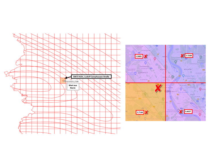
Example
Location: Ludolf Camphausen Street in Cologne
As you can see in the image, the location in the cell is located at 6.9° east and 50.9° north. This results in a response acceleration of 1.7144 m/s² for the location in question, as it is not interpolated.